Lake Okeechobee Waterway Locks
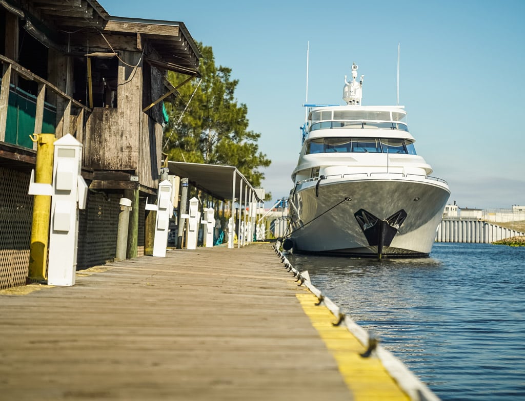
Roland Martin Marina – The most popular stop on the waterway!
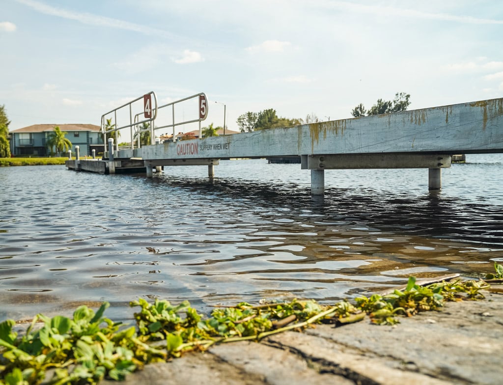
Welcome to Lake Okeechobee and the Okeechobee Waterway! Located in central and southern Florida, the 451,000 acre lake and 154 mile long Okeechobee waterway extends from the Atlantic Ocean at Stuart Florida, to the Gulf of Mexico at Ft. Myers, Florida. The Okeechobee waterway runs through Lake Okeechobee and is made up of two rivers theYacht traveling to roland martin marina on the okeechobee waterway Caloosahatchee River to the west of the lake and the St. Lucie Canal east of the lake.Roland Martin’s Marina is considered the half way point on the waterway and is the place to stop when needing supplies, parts, fuel, motel rooms and great food. Please check out our web-site and see why we are the #1 stop on the Okeechobee Waterway. If you have time try one of our guided bass fishing trips or even a wild and fun Air-Boat ride.
Roland Martin Marina – Lake Okeechobee Marina Features
- 1000 feet of linear floating dockage equipped with 30 & 50 amp service and water.
- covered boat slips equipped with power.
- Boat lifts are available on some slips.
- Dry Boat Storage also available.
- Large Boat and Yacht Dockage (over 21 foot)
- A Tiki Bar on the water and a Restaurant close to the docks.
- A Marine Center on property for repairs and accessories.
The Okeechobee Waterway is a favorite for boaters and motor yachts to save on time and fuel by shaving off two – three day travel time by cutting across the state instead of going all the way around the tip of Florida. The Okeechobee Waterway is very safe and is one of the most beautiful ways to see the “Old Florida”
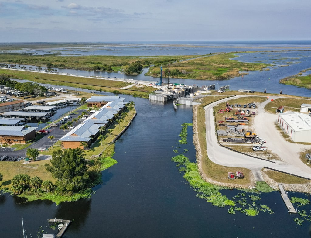
Lake Okeechobee and the Okeechobee Waterway Project is part of the complex water management system known as the Central and Southern Florida Flood Control Project.Lake Okeechobee Lock system on the cross florida waterwayThe projects cover 16,000 square miles starting just south of Orlando and extending southward through the Kissimmee River Basin to the Everglades National Park to Florida Bay.
The U.S. Army Corps of Engineers South Florida Operations Office (SFOO) manages and operates 5 navigation locks and dams along the Okeechobee Waterway:. St. Lucie Lock & Dam at Stuart, Port Mayaca Lock & Dam near Canal Point, Moore Haven Lock & Dam at Moore Haven, Ortona Lock & Dam near LaBelle and W. P. Franklin Lock & Dam near Ft. Myers. The SFOO also manages the Canaveral Lock at Canaveral Harbor, Florida.
Okeechobee Waterway Lock info
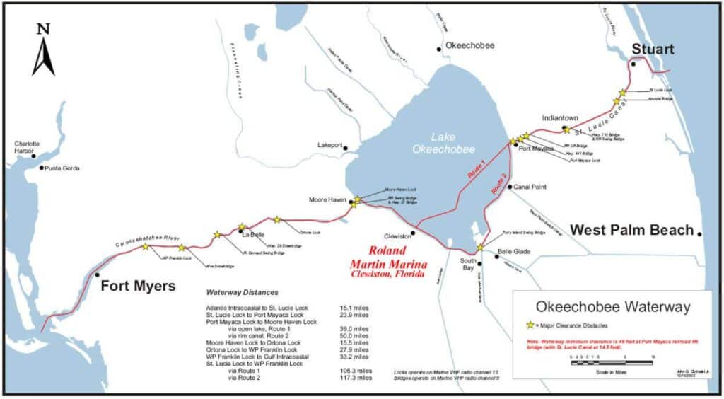
There are five locks on the Lake Okeechobee intracoastal waterways (from east to west):
St. Lucie Lock 50 x 250 feet 772-287-2665
Port Mayaca Lock 56 x 400 feet 561-924-2858
Moore Haven Lock 50 x 250 feet 863-946-0414
Ortona Lock 50 x 250 feet 863-675-0616
W.P. Franklin Lock 56 x 400 feet 239-694-5451
For current information on water depths, lockage and navigational routes, contact:
Army Corps of Engineers at 904-232-3187 (Jacksonville District Office)
South Florida Operations Office, Clewiston at (863)983-8101
Okeechobee Field Office at (863)462-5260
Distances
Atlantic Intracoastal to St. Lucie Lock 15.1 miles
St. Lucie Lock to Port Mayaca Lock 23.7 miles
Port Mayaca Lock to Moore Haven Lock
Via open lake, route 1 39.0 miles
Via rim canal, route 2 50.0 miles
Moore Haven Lock to Ortona Lock 15.5 miles
Ortona Lock to W.P. Franklin Lock 27.9 miles
W.P. Franklin Lock to Gulf Intracoastal 33.2 miles